Import a Terrain
Instead of modeling, you can read the terrain point coordinates from a file, which can be of TXT, CSV or SOS format. In TXT and CSV files, the Z, Y and Z coordinates of each point are on their own lines separated by commas. A TXT file may look like this, for example:
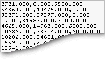
 The coordinates are specified in millimeters in the file. If you are using the Imperial system, the coordinates are specified in inches.
You can also read the terrain points from a .las or .laz point cloud file, if you are using the Point Clouds add-on feature of the software.
- Select Modeling | Zone |
 Terrain
 Import Terrain.
 - Select the file in the Open dialog box.
- Click the Open button.
- Select the terrain properties in the dialog box.
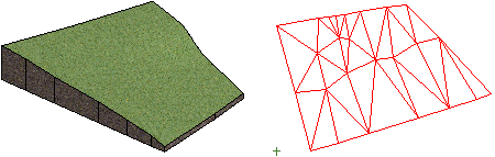
The terrain is modeled in the model window, and the point mesh is drawn in the drawing.