Preparations
We recommend modeling a terrain in its own drawing-model pair. The template projects in the basic software delivery include a Terrain drawing-model pair. Activate the drawing-model pair before modeling the terrain.
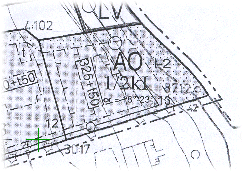
Before adding the terrain, sketch the lot boundaries and elevation curves by drawing them using line functions. You can base the modeling on a map. You can read a map in TIF format into the 2D drawing with the raster image function.
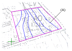
Draw the lot borders and elevation curves over the raster image using line functions. You can draw the elevation curves as open curves (A). Delete the raster when you are finished drawing the lines. When adding the terrain, select the points or lines you drew and specify their heights.
If the map is in DWG or DXF format, you can read the map into the 2D drawing as a reference drawing. You can then select the height points or elevation curves directly from the reference drawing when adding the terrain.
Instead of modeling, you can also import the terrain as a text file (TXT), CSV file or a SOS file.
Region Splits and Excavations
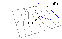
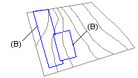
You can create road and yard areas in the terrain and make excavations. First draw the edge lines of the region or excavation in the 2D drawing so that they form a closed polyline (B).
The edge line may include circular or elliptical arcs (C) but not other curves. The edge lines of the region or excavation can reach outside the edge lines of the terrain (D).